


GeoSpatial Solutions |
 |
|
Galdos Systems Inc. is the original creator of Geography Markup Language (GML) and a world leader in the development and application of geospatial open standards for municipal, state, and national information systems:
ü Consulting Services Galdos Systems creates road maps for the adoption of open standards such as OGC, ISO TC211, and TC204, including assessing the readiness level of an enterprise or group of enterprises. Galdos reviews existing technology, standards, and available training programs, and provides a gap analysis. Galdos helps enterprises and multi-enterprise communities to select the standards which are key to their information management needs and objectives and shows how (and why) using open standards contributes to an organization’s ROI.
ü Training Galdos also provides complete standards training programs, from awareness education for senior executives to detailed training on individual standards for developers, systems analysts, and database administrators.
ü System Implementation Galdos Systems develops complete system architectures and implementation plans for the employment of open standards at the State, National, Provincial, or Municipal level. Galdos implements GIS Centers, Enterprise GIS, and Spatial Data Infrastructures (SDI’s) using Galdos and third party components such as ESRI GeoPortal and Oracle Spatial, as well as Enterprise Service Buses such as IBM WebSphere. Galdos implementations are cost effective and ensure adherence to the selected geospatial open standards that maximize the ROI for the Enterprise and/or the community.
ü Galdos Components: o INdicio™ Registry
o INtune™ Data Synchronization Framework INtune is a Data Synchronization Framework for developing data sharing and Spatial Data Infrastructure (SDI) solutions. It provides a platform for building peer-to-peer networks for secure, automatic, incremental, real-time, synchronized data sharing using a publication/subscription model. INtune provides a central control and administration utility, as well as access control and authentication to support business needs.
o INscape™ Web Feature Service INscape is a transactional Web Feature Service (WFS) that addresses the need for interoperable and standardized geographic information systems and services. INscape WFS is a robust and scalable software solution that can be implemented on top of existing relational databases such as Oracle and NoSQL databases such as EMC xDB.
o INspector™ GML Viewer
o INview™ GML JPEG 2000 Editor INview is a GML JPEG 2000 viewer with support for custom annotations. INview displays embedded GML Annotations such as points, lines, and areas as overlays on the JPEG 2000 image.
o GML Software Development Kit (GML SDK™) GML SDK is a simple and powerful way to integrate GML into existing applications. Galdos uses the GML SDK for GML schema development, and as part of the process for auditing and quality assurance of GML schemas.
|
|
|

+971 (4) 420-7898
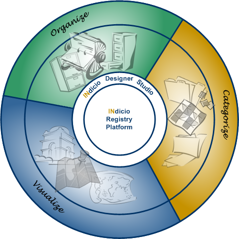 INdicio offers a new kind of Information Management Solution — a web service and solution with spatial capabilities which accelerates the development of enterprise solutions. INdicio includes an intuitive NoSQL data model, virtualization support, and is highly extensible, with every object (including users) having a globally unique ID to support complete traceability of who changed what and when, including life cycle status changes. The INdicio Designer Studio allows application information models to be built, deployed, and managed visually, and existing models to be extended and re-deployed to update the associated registry.
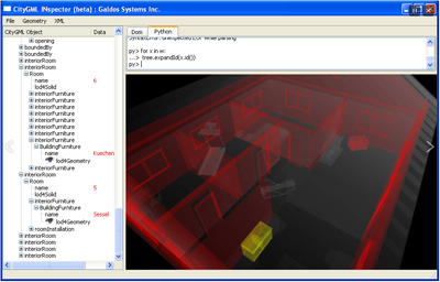 INspector is a desktop application that offers very fast, efficient viewing of GML and CityGML data. It maintains a small footprint even with very large files, and offers several different visualization modes for how the data is displayed.
Serving Telecom Operators, Oil/Gas Owner Operators, Banking, Financial Institutions, as well as private and government sectors.
OUR SOLUTIONS
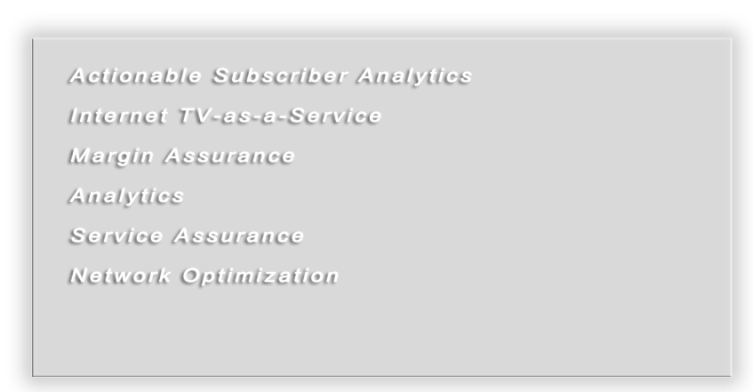
Telecom

Actionable Subscriber Analytics, Internet TV-as-a-Service, Margin Assurance, Analytics, Service Assurance, Network Optimization ...
Information Technology

SAP BCM Rapid Deployment Solutions, SAP Business All-in-One, Real-time validation and distribution of Geospatial data and content ...
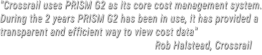
Integrated Cost Management

ARES Corporation is one of the foremost Engineering, Project Management, Reliability and Mission Assurance, IT Architecture and ...

Security Solutions

Perimeter Intrusion Detection, Communications and Cyber Intelligence, Situational Awareness, Threats/Vulnerabilities Assessment.
Financial/Treasury Management

Financial, Proactive Treasury Management (SAAS), Cash and Liquidity Management, Bank Relationship Management,...
Contact Information
Surety Computer Systems L.L.C, P.O. Box 102729 Office 703, Icon Tower, TECOM, Dubai, United Arab Emirates
+971 (4) 420-7898
+971 (4) 420-8289
admin@surety-cs.com
www.surety-cs.com